
Chart
At Kayakstore.se you can find an extensive range of charts for your plotter. Using charts is essential to increase safety and optimize your fishing when you are out on the lake. We strongly recommend that you invest in a chart that fits your specific device.
Are you looking for chart the Baltic Sea , chart Karlskrona , nautical charts kattegatt , Danish nautical charts, Finnish nautical charts or nautical charts in other parts of Europe, we have something for you all to offer!
We have charts for your plotter from many of the most well-known brands such as C-Map , Blue Chart, Navionics Charts , Garmin Charts, etc.
Original price
1 790 kr
Original price
1 790 kr
-
Original price
1 790 kr
Original price
1 790 kr
Current price
1 089 kr
1 089 kr
-
1 089 kr
Current price
1 089 kr
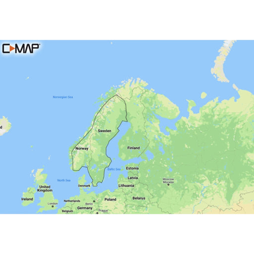
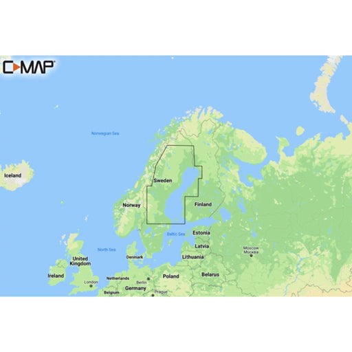
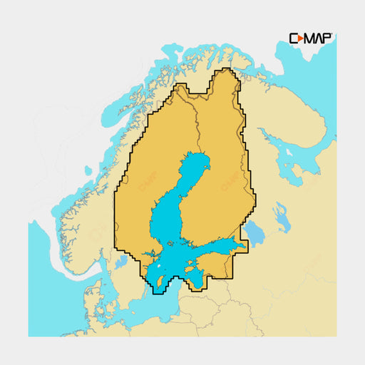
C-MAP DISCOVER - Scandinavia Inland Waters
C-MAP
In stock
Discover M-EN Y210 Scandinavia Inland Waters Discover has everything you need to make the most of your time on the water. Full vector graphics w...
View full details
Original price
1 790 kr
Original price
1 790 kr
-
Original price
1 790 kr
Original price
1 790 kr
Current price
1 089 kr
1 089 kr
-
1 089 kr
Current price
1 089 kr
Sale
Original price
2 590 kr
Original price
2 590 kr
-
Original price
2 590 kr
Original price
2 590 kr
Current price
1 089 kr
1 089 kr
-
1 089 kr
Current price
1 089 kr
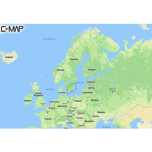
C-MAP DISCOVER - Baltic Sea
C-MAP
In stock
Discover M-EN Y055 Baltic Sea Continental C-MAP Discover - whether you're cruising or fishing, C-MAP® DISCOVER™ provides a selection ...
View full details
Original price
2 590 kr
Original price
2 590 kr
-
Original price
2 590 kr
Original price
2 590 kr
Current price
1 089 kr
1 089 kr
-
1 089 kr
Current price
1 089 kr
Sale
Original price
1 790 kr
Original price
1 790 kr
-
Original price
1 790 kr
Original price
1 790 kr
Current price
1 089 kr
1 089 kr
-
1 089 kr
Current price
1 089 kr
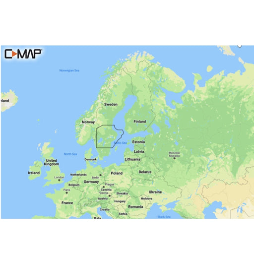
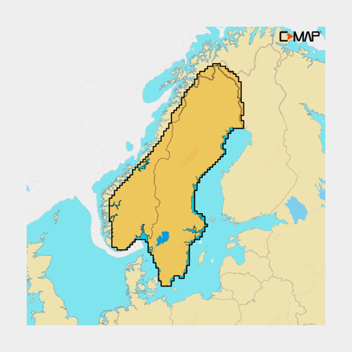
C-MAP DISCOVER - Västervik to Söderhamn
C-MAP
Low stock
C-MAP Discover - whether you're cruising or fishing, C-MAP® DISCOVER™ provides a selection of coverage areas with all the key features you need ...
View full details
Original price
1 790 kr
Original price
1 790 kr
-
Original price
1 790 kr
Original price
1 790 kr
Current price
1 089 kr
1 089 kr
-
1 089 kr
Current price
1 089 kr
Sale
Original price
2 629 kr
Original price
2 629 kr
-
Original price
2 629 kr
Original price
2 629 kr
Current price
1 499 kr
1 499 kr
-
1 499 kr
Current price
1 499 kr
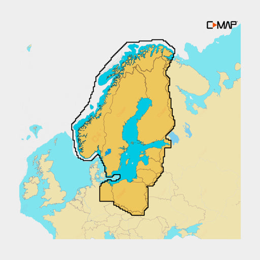
C-MAP REVEAL - Scandinavia Inland
C-MAP
In stock
REVEAL - Scandinavia Inland Y580 C-MAP Reveal - for the angler who wants it all. The C-MAP® REVEAL™ chart provides the very best of ...
View full details
Original price
2 629 kr
Original price
2 629 kr
-
Original price
2 629 kr
Original price
2 629 kr
Current price
1 499 kr
1 499 kr
-
1 499 kr
Current price
1 499 kr
Sale
Original price
2 629 kr
Original price
2 629 kr
-
Original price
2 629 kr
Original price
2 629 kr
Current price
1 499 kr
1 499 kr
-
1 499 kr
Current price
1 499 kr
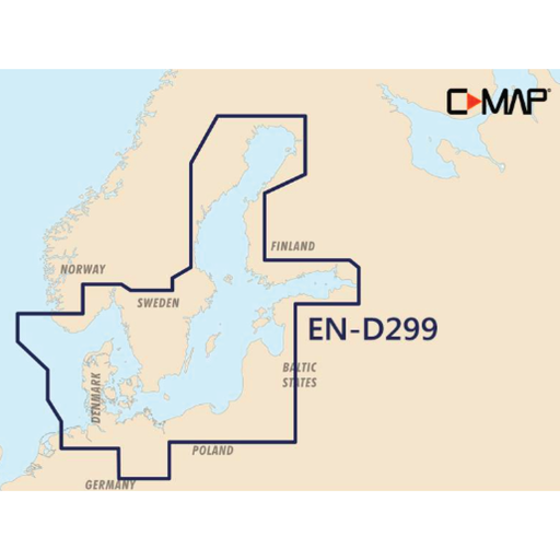
C-MAP REVEAL - Baltic Sea & Denmark
C-MAP
Low stock
Reveal M-EN Y299 Baltic Sea Most of Sweden (with western Jämtland partly gone and not quite at the top of the North) and Denmark with parts of N...
View full details
Original price
2 629 kr
Original price
2 629 kr
-
Original price
2 629 kr
Original price
2 629 kr
Current price
1 499 kr
1 499 kr
-
1 499 kr
Current price
1 499 kr
Sale
Original price
1 790 kr
Original price
1 790 kr
-
Original price
1 790 kr
Original price
1 790 kr
Current price
1 089 kr
1 089 kr
-
1 089 kr
Current price
1 089 kr
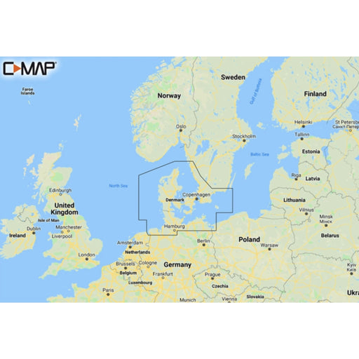
C-MAP DISCOVER - Malmö to Valdermarsvik
C-MAP
In stock
Discover M-EN Y207 Malmö-Valdemarsvik C-MAP Discover - whether you're cruising or fishing, C-MAP® DISCOVER™ provides a selection of cov...
View full details
Original price
1 790 kr
Original price
1 790 kr
-
Original price
1 790 kr
Original price
1 790 kr
Current price
1 089 kr
1 089 kr
-
1 089 kr
Current price
1 089 kr
Sale
Original price
1 790 kr
Original price
1 790 kr
-
Original price
1 790 kr
Original price
1 790 kr
Current price
1 089 kr
1 089 kr
-
1 089 kr
Current price
1 089 kr
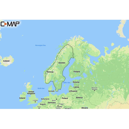
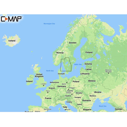
C-MAP DISCOVER - Torekov to Larvik
C-MAP
In stock
Discover M-EN Y206 Torekov-Larvik Discover has everything you need to make the most of your time on the water. Full vector graphics with high reso...
View full details
Original price
1 790 kr
Original price
1 790 kr
-
Original price
1 790 kr
Original price
1 790 kr
Current price
1 089 kr
1 089 kr
-
1 089 kr
Current price
1 089 kr
Sale
Original price
1 790 kr
Original price
1 790 kr
-
Original price
1 790 kr
Original price
1 790 kr
Current price
1 089 kr
1 089 kr
-
1 089 kr
Current price
1 089 kr
C-MAP DISCOVER - Karlskrona to Emden
C-MAP
In stock
Discover M-EN Y205 Karlskrona-Emden C-MAP Discover - whether you're cruising or fishing, C-MAP® DISCOVER™ provides a selection of cover...
View full details
Original price
1 790 kr
Original price
1 790 kr
-
Original price
1 790 kr
Original price
1 790 kr
Current price
1 089 kr
1 089 kr
-
1 089 kr
Current price
1 089 kr
Sale
Original price
1 829 kr
Original price
1 829 kr
-
Original price
1 829 kr
Original price
1 829 kr
Current price
1 629 kr
1 629 kr
-
1 629 kr
Current price
1 629 kr
C-MAP DISCOVER X - Skagerrak, Kattegatt & Östersjön
C-MAP
In stock
Kasta loss med C-MAP Reveal X - det perfekta sjökortet för båtägare som använder Simrad NSX och B&G Zeus S-enheter. Detta omfattande sjökort l...
View full details
Original price
1 829 kr
Original price
1 829 kr
-
Original price
1 829 kr
Original price
1 829 kr
Current price
1 629 kr
1 629 kr
-
1 629 kr
Current price
1 629 kr
Sale
Original price
1 790 kr
Original price
1 790 kr
-
Original price
1 790 kr
Original price
1 790 kr
Current price
1 089 kr
1 089 kr
-
1 089 kr
Current price
1 089 kr
C-MAP DISCOVER - Gulf of Bothnia
C-MAP
In stock
Discover M-EN Y209 Gulf Of Bothnia Discover has everything you need to make the most of your time on the water. Full vector graphics with high r...
View full details
Original price
1 790 kr
Original price
1 790 kr
-
Original price
1 790 kr
Original price
1 790 kr
Current price
1 089 kr
1 089 kr
-
1 089 kr
Current price
1 089 kr
Sale
Original price
1 959 kr
Original price
1 959 kr
-
Original price
1 959 kr
Original price
1 959 kr
Current price
1 895 kr
1 895 kr
-
1 895 kr
Current price
1 895 kr
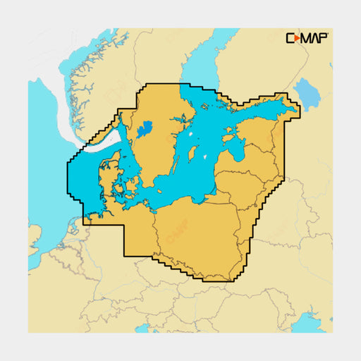
C-MAP 4D - Baltic Sea and Denmark
C-MAP
Low stock
This chart from C-MAP covers the entire Baltic Sea up to St. Petersburg as well as the Swedish and Finnish coasts including Denmark.
Original price
1 959 kr
Original price
1 959 kr
-
Original price
1 959 kr
Original price
1 959 kr
Current price
1 895 kr
1 895 kr
-
1 895 kr
Current price
1 895 kr
Sale

Original price
2 490 kr
Original price
2 490 kr
-
Original price
2 490 kr
Original price
2 490 kr
Current price
1 089 kr
1 089 kr
-
1 089 kr
Current price
1 089 kr
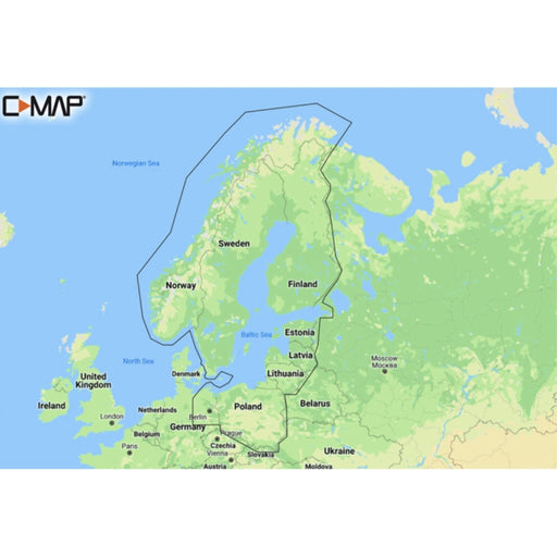
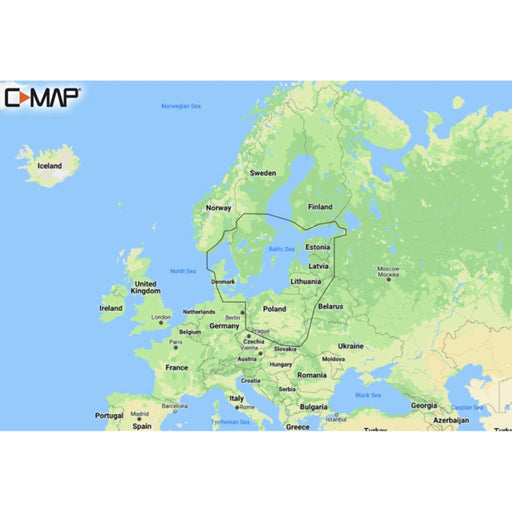
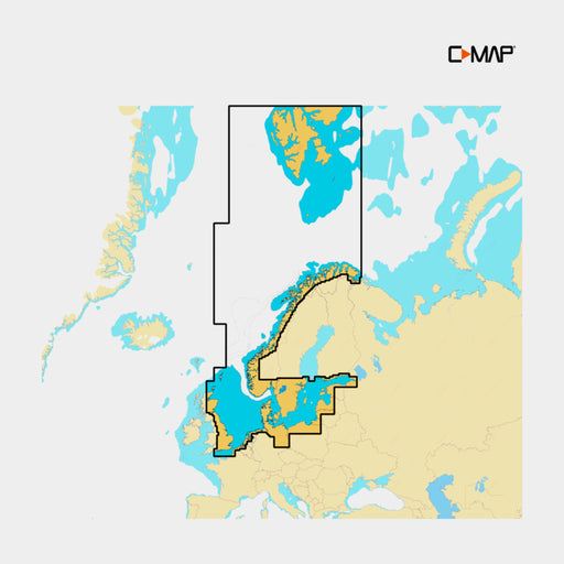
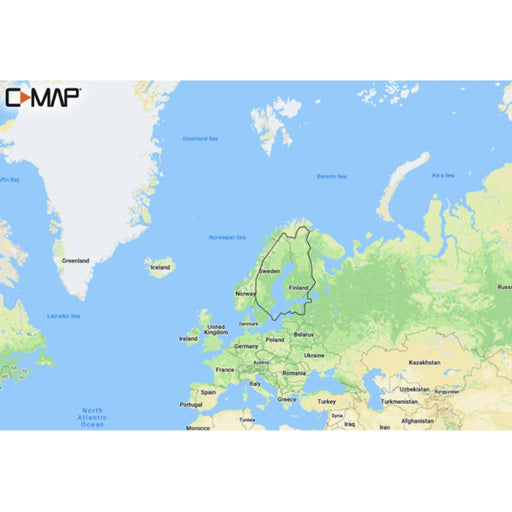
C-Map DISCOVER - Northern & Central Europe
C-MAP
In stock
Discover M-EN Y050 Northern & Central Europe Continental Discover has everything you need to make the most of your time on the water. Full v...
View full details
Original price
2 490 kr
Original price
2 490 kr
-
Original price
2 490 kr
Original price
2 490 kr
Current price
1 089 kr
1 089 kr
-
1 089 kr
Current price
1 089 kr
Sale

Original price
2 869 kr
Original price
2 869 kr
-
Original price
2 869 kr
Original price
2 869 kr
Current price
2 469 kr
2 469 kr
-
2 469 kr
Current price
2 469 kr
C-MAP REVEAL X - Norges & Sveriges sjöar
C-MAP
Low stock
Utforska världens hav med C-MAP Reveal X - den ultimata navigationslösningen skapad för båtägare som använder Simrad NSX och B&G Zeus S-enhet...
View full details
Original price
2 869 kr
Original price
2 869 kr
-
Original price
2 869 kr
Original price
2 869 kr
Current price
2 469 kr
2 469 kr
-
2 469 kr
Current price
2 469 kr
Sale

Original price
2 869 kr
Original price
2 869 kr
-
Original price
2 869 kr
Original price
2 869 kr
Current price
2 469 kr
2 469 kr
-
2 469 kr
Current price
2 469 kr
C-MAP REVEAL X - Finlands sjöar & Östersjön
C-MAP
Out of stock
Utforska världens hav med C-MAP Reveal X - den ultimata navigationslösningen skapad för båtägare som använder Simrad NSX och B&G Zeus S-enhet...
View full details
Original price
2 869 kr
Original price
2 869 kr
-
Original price
2 869 kr
Original price
2 869 kr
Current price
2 469 kr
2 469 kr
-
2 469 kr
Current price
2 469 kr
Sold out

Original price
2 869 kr
Original price
2 869 kr
-
Original price
2 869 kr
Original price
2 869 kr
Current price
2 469 kr
2 469 kr
-
2 469 kr
Current price
2 469 kr
C-MAP REVEAL X - Skagerrak, Kattegatt & Östersjön
C-MAP
Low stock
Utforska världens hav med C-MAP Reveal X - den ultimata navigationslösningen skapad för båtägare som använder Simrad NSX och B&G Zeus S-enhet...
View full details
Original price
2 869 kr
Original price
2 869 kr
-
Original price
2 869 kr
Original price
2 869 kr
Current price
2 469 kr
2 469 kr
-
2 469 kr
Current price
2 469 kr
Sale
Original price
2 639 kr
Original price
2 639 kr
-
Original price
2 639 kr
Original price
2 639 kr
Current price
2 439 kr
2 439 kr
-
2 439 kr
Current price
2 439 kr
C-MAP DISCOVER X - Norr- & centraleuropa
C-MAP
Low stock
Kasta loss med C-MAP Reveal X - det perfekta sjökortet för båtägare som använder Simrad NSX och B&G Zeus S-enheter. Detta omfattande sjökort ...
View full details
Original price
2 639 kr
Original price
2 639 kr
-
Original price
2 639 kr
Original price
2 639 kr
Current price
2 439 kr
2 439 kr
-
2 439 kr
Current price
2 439 kr
Sale
Original price
1 829 kr
Original price
1 829 kr
-
Original price
1 829 kr
Original price
1 829 kr
Current price
1 629 kr
1 629 kr
-
1 629 kr
Current price
1 629 kr
C-MAP DISCOVER X - Finlands sjöar & Östersjön
C-MAP
Low stock
Kasta loss med C-MAP Reveal X - det perfekta sjökortet för båtägare som använder Simrad NSX och B&G Zeus S-enheter. Detta omfattande sjökort ...
View full details
Original price
1 829 kr
Original price
1 829 kr
-
Original price
1 829 kr
Original price
1 829 kr
Current price
1 629 kr
1 629 kr
-
1 629 kr
Current price
1 629 kr
Sale
Original price
1 829 kr
Original price
1 829 kr
-
Original price
1 829 kr
Original price
1 829 kr
Current price
1 629 kr
1 629 kr
-
1 629 kr
Current price
1 629 kr
C-MAP DISCOVER X - Norges & Sveriges sjöar (Norway and Sweden Inlands)
C-MAP
In stock
Kasta loss med C-MAP Reveal X - det perfekta sjökortet för båtägare som använder Simrad NSX och B&G Zeus S-enheter. Detta omfattande sjökort ...
View full details
Original price
1 829 kr
Original price
1 829 kr
-
Original price
1 829 kr
Original price
1 829 kr
Current price
1 629 kr
1 629 kr
-
1 629 kr
Current price
1 629 kr
Sale
Original price
2 639 kr
Original price
2 639 kr
-
Original price
2 639 kr
Original price
2 639 kr
Current price
2 439 kr
2 439 kr
-
2 439 kr
Current price
2 439 kr
C-MAP DISCOVER X - Sverige, Finland, Norge & Östersjön
C-MAP
Out of stock
Kasta loss med C-MAP Reveal X - det perfekta sjökortet för båtägare som använder Simrad NSX och B&G Zeus S-enheter. Detta omfattande sjökort ...
View full details
Original price
2 639 kr
Original price
2 639 kr
-
Original price
2 639 kr
Original price
2 639 kr
Current price
2 439 kr
2 439 kr
-
2 439 kr
Current price
2 439 kr
Sold out
Original price
2 590 kr
Original price
2 590 kr
-
Original price
2 590 kr
Original price
2 590 kr
Current price
1 499 kr
1 499 kr
-
1 499 kr
Current price
1 499 kr
C-MAP REVEAL - Finland Lakes
C-MAP
In stock
Reveal M-EN Y326 Finland Lakes REVEAL charts bring you the best of C-MAP, including Shaded Relief now available everywhere. Functions Full...
View full details
Original price
2 590 kr
Original price
2 590 kr
-
Original price
2 590 kr
Original price
2 590 kr
Current price
1 499 kr
1 499 kr
-
1 499 kr
Current price
1 499 kr
Sale
Original price
1 990 kr
-
Original price
1 990 kr
Original price
1 990 kr
1 990 kr
-
1 990 kr
Current price
1 990 kr
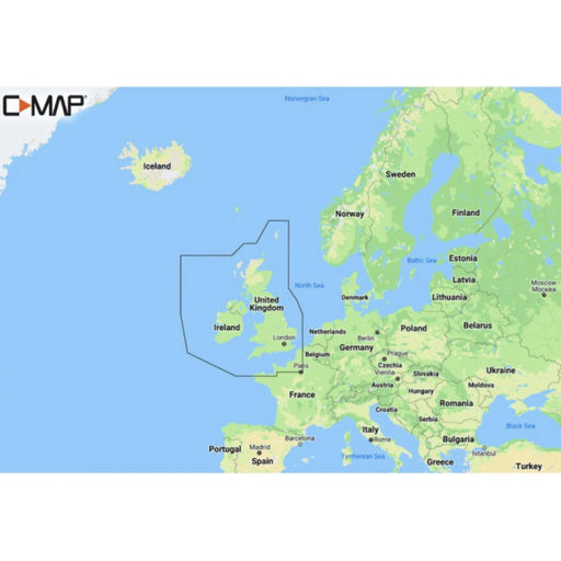
DISCOVER - United Kingdom & Ireland
C-MAP
In stock
Discover M-EW Y200 United Kingdom & Ireland Discover has everything you need to make the most of your time on the water. Full vector graphics...
View full details
Original price
1 990 kr
-
Original price
1 990 kr
Original price
1 990 kr
1 990 kr
-
1 990 kr
Current price
1 990 kr
Original price
1 790 kr
Original price
1 790 kr
-
Original price
1 790 kr
Original price
1 790 kr
Current price
1 089 kr
1 089 kr
-
1 089 kr
Current price
1 089 kr
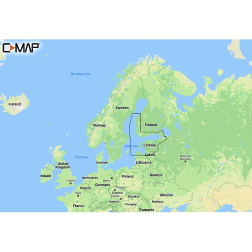
C-Map DISCOVER - Gulf of Finland & Åland Islands Archipelago
C-MAP
In stock
Discover M-EN Y212 Gulf of Finland & Åland Discover has everything you need to make the most of your time on the water. Full vector graphics...
View full details
Original price
1 790 kr
Original price
1 790 kr
-
Original price
1 790 kr
Original price
1 790 kr
Current price
1 089 kr
1 089 kr
-
1 089 kr
Current price
1 089 kr
Sale
Original price
1 790 kr
Original price
1 790 kr
-
Original price
1 790 kr
Original price
1 790 kr
Current price
1 599 kr
1 599 kr
-
1 599 kr
Current price
1 599 kr
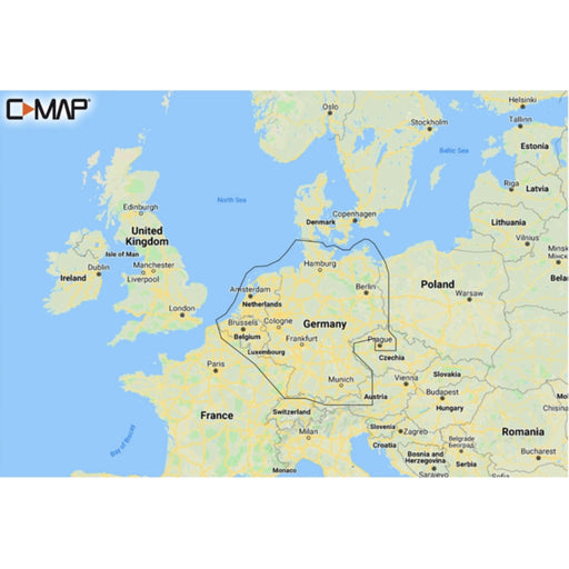
C-Map DISCOVER - Germany & Netherland Inland
C-MAP
In stock
Discover M-EN Y215 Germany & Netherland Inland Discover has everything you need to make the most of your time on the water. Full vector grap...
View full details
Original price
1 790 kr
Original price
1 790 kr
-
Original price
1 790 kr
Original price
1 790 kr
Current price
1 599 kr
1 599 kr
-
1 599 kr
Current price
1 599 kr
Sale
Original price
1 790 kr
Original price
1 790 kr
-
Original price
1 790 kr
Original price
1 790 kr
Current price
1 599 kr
1 599 kr
-
1 599 kr
Current price
1 599 kr
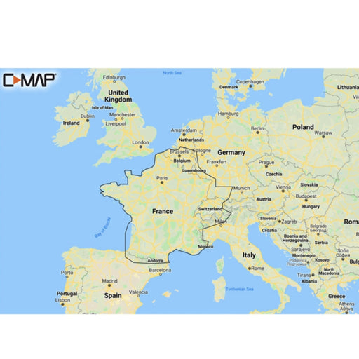
C-MAP DISCOVER - French Inland Waters
C-MAP
Out of stock
Discover M-EW Y206 French Inland Waters Discover has everything you need to make the most of your time on the water. Full vector graphics with h...
View full details
Original price
1 790 kr
Original price
1 790 kr
-
Original price
1 790 kr
Original price
1 790 kr
Current price
1 599 kr
1 599 kr
-
1 599 kr
Current price
1 599 kr
Sold out
Original price
1 790 kr
Original price
1 790 kr
-
Original price
1 790 kr
Original price
1 790 kr
Current price
1 089 kr
1 089 kr
-
1 089 kr
Current price
1 089 kr
C-MAP DISCOVER - Finland Lakes
C-MAP
In stock
Discover M-EN Y211 Finland Lakes Discover has everything you need to make the most of your time on the water. Full vector graphics with high res...
View full details
Original price
1 790 kr
Original price
1 790 kr
-
Original price
1 790 kr
Original price
1 790 kr
Current price
1 089 kr
1 089 kr
-
1 089 kr
Current price
1 089 kr
Sale

Original price
1 790 kr
Original price
1 790 kr
-
Original price
1 790 kr
Original price
1 790 kr
Current price
1 599 kr
1 599 kr
-
1 599 kr
Current price
1 599 kr
C-Map DISCOVER - Benelux Inland & Coastal
C-MAP
Out of stock
Discover M-EN Y216 Benelux Inland & Coastal Discover has everything you need to make the most of your time on the water. Full vector graphic...
View full details
Original price
1 790 kr
Original price
1 790 kr
-
Original price
1 790 kr
Original price
1 790 kr
Current price
1 599 kr
1 599 kr
-
1 599 kr
Current price
1 599 kr
Sold out