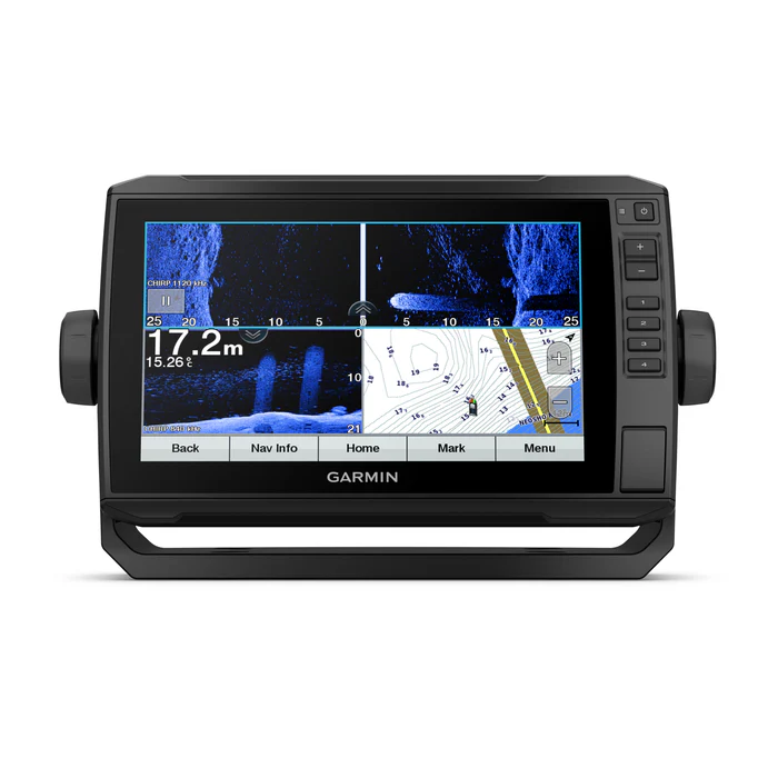
Garmin ECHOMAP UHD 9" plotter, 92sv utan givare
Garmin Echomap UHD 92sv without sensor
(Adapter cable 8pin included)
This chartplotter has a 9-inch screen that can be read in sunlight, has a quick-release bar mount and traditional CHIRP sonar.
• With the sensor ( not included in this package ) you can see what is under and around the boat with incredible detail
• Navigate all waters with optional charts and maps
• Share data with other devices on the network (7- and 9-inch models only)
• Control your marine experience almost anywhere
• Control the most powerful trolling engine available
• Create your own maps as you drive and tailor them to your needs
See below and around your boat in incredible detail with the transducer bundle.
Navigate any waters with optional charts and maps (sold separately).
Share data and maps with select ECHOMAP devices on your network.
Manage your marine experience from almost anywhere 1 .
Control the most powerful trolling motor available 2 .
Create your own maps on the fly and tailor them to fit your needs.
Content:
- ECHOMAP UHD 92sv with global base map
- Charging/data cable
- Quick mount with tilt/rotate
- Recessed mounting
- Protective cover
- Hardware
- Documentation
Generally:
- Physical dimensions: 28.2 x 16.4 x 6.0 cm
- Screen size, W x H: 19.9 x 11.3 cm; 22.9 cm (9.0") diagonal
- Screen resolution, W x H: 400 x 800 pixels
- Screen type: WVGA screen
- Weight: 1.0 kg
- Water rating: IPX7
- Power consumption: 18 W
- Antenna: Internal or external via NMEA 2000
- Mounting options: Mounting bracket or recessed mounting
- Receiver: 5 Hz
- Garmin Marine Network™ Ports: None
Maps and memory
- Preloaded maps: Global base map
- Accepts data cards: 1 microSD™ card, 32 GB maximum size
- Waypoints: 5,000
- Routes: 100
- Track log: 50,000 points; 50 saved tracks
Outdoor and leisure activities
- Tide Tables: Yes
Recommended plotters
- Compatible with Garmin sonar: Yes
- Supports AIS (tracks the position of object ships): Yes
- Supports DSC (displays position data from VHF radio with DSC function): Yes
- GCV™ Black Box Sonar Support: Yes
- Compatible with ActiveCaptain: Yes
- Sailing features: Yes
Recommended sonar and specifications
- Sonar function with two frequencies: Yes
- Dual beam sonar function: Yes
- Transmission power: 500 W (RMS) / 4000 W (peak-to-peak)
- CHIRP sonar technology: Yes (built-in)
- ClearVü Yes with CHIRP (built-in)
- SideVü Yes with CHIRP (built-in)
- Maximum depth: 700 meters at 77 kHz, in fresh water, 335 meters at 77 kHz, salt water, (depth capacity depends on water bottom type and other water conditions)
- Bottom lock (shows return from the bottom up): Yes
- Log and graph of water temperature: Yes
- Sonar recording: Yes
- Sonar history rewind: Yes
Connections
- Compatible with NMEA 2000®: Yes
- Number of sensor poles: 12
- NMEA 0183 input ports: 1
- NMEA 0183 output ports: 1
- Video input port: None
- Video output ports: None
- Wireless connection: Yes
| Article number: 010-02341-00 |


